The Pleistocene Epoch
So Little Time, So Much To Do
The Pleistocene
Epoch is the vast
majority
of the Neocene Period. It
lasted from 1.8 million years ago until about 10,000 years ago.
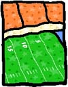 If the Geologic
Timeline were laid out on a 100 yard football field, the Neocene Period
would
be the last inch and a half, with the Pleistocene Epoch
taking
up all but the last 1/64th of an inch! If the Geologic
Timeline were laid out on a 100 yard football field, the Neocene Period
would
be the last inch and a half, with the Pleistocene Epoch
taking
up all but the last 1/64th of an inch!
The inch and a half would represent
approximately 1.8 million years of geologic time. In that time,
there
would be at least four separate episodes of advancing and retreating glaciers that,
together
with the debris they scooped up and brought along with them, would have
the
combined effect of 'polishing' our mountains and exposed bedrock to a
new
level of roundedness and smoothness.
 Many mountains took
on the shape of roche moutonees
(roash
MOO-ton-ays). That's a French term meaning 'rock sheep' - because roche
moutonees look like sheep lying on the ground! Many mountains took
on the shape of roche moutonees
(roash
MOO-ton-ays). That's a French term meaning 'rock sheep' - because roche
moutonees look like sheep lying on the ground!
Cannon Mountain is a classic roche
moutonee. The northern and western side is a gradually rising
slope.
Its southern and eastern sides features cliffs and a talus slope. This
is where the profile of the Old Man of the Mountain was located.

The
roche moutonee, or sheep's back shape of Cannon Mountain
(Click on the image for a closer look.)|
Image
credit: Daniel E. Reidy
 Glaciers started to form approximately 1.8 million
years ago at the
beginning of the Neocene Period. Glaciers started to form approximately 1.8 million
years ago at the
beginning of the Neocene Period.
Glaciers
form when the climate gets cool enough so that not all of a winter's
snow
melts in the summer. The snow starts to accumulate year after year.
As
more and more snow stays behind, more and more sunlight is reflected
back
into space making the area even cooler. This increasing coolness
fosters
more snow accumulation and less melting. It becomes a vicious
cycle
that creates snow packs more than a mile thick!
Natures Sandpaper
The overlying weight of the
upper
snow levels cause the lower levels of the snowpack to turn to ice,
embedding
sand, gravel, and rocks of all sizes in the underside of the glacier.
 These bits of sand,
gravel and rocks make the glacier behave like
sandpaper. It smooths out the landscape as the glacier starts to move
outward
along all its edges due to the weight of the ice pack at the center of
the glacier. These bits of sand,
gravel and rocks make the glacier behave like
sandpaper. It smooths out the landscape as the glacier starts to move
outward
along all its edges due to the weight of the ice pack at the center of
the glacier.
Ice alone cannot wear down mountains
and leave scratches (striations) in bedrock.
Try rubbing ice cubes on a brick.
You won't notice much, if any, effect on the brick. Try this
experiment
again with ice cubes that have sand and gravel in them. You'll notice
the
difference!
The Glacier's Calling Cards
In the days before telephone
answering
machines and email (yes, there was a time without these electronic
wonders),
people wishing to do business with you would actually show up in person
(what
a concept).
If they happened to miss you, they
would leave a small calling card with their name, phone number and
address
on it to let you know they had come by.
The last advance and retreat of
the glaciers left several calling
cards on our landscape.
The glacier's passing has created
many of today's landforms such as kettle hole ponds,
eskers, kames, boulder
caves, talus slopes, drumlins, glacial valleys
and deltas.
Glaciers also
caused
flooding of coastal portions of our state and the drowning of forests,
the
transportation of large boulders from one area of the Northeast to
another
(glacial boulders and glacial erratics),
the
creation and the drainage of vast glacial lakes, and the
openings
of gaps, or notches in the mountains.
Some of New Hampshire's weathered
and eroded bedrock (sand made up of quartz granules from weathered
and eroded granite) ended up at the leading edge of the
greatest
advance of the ice sheets and become part of what is today Cape Cod,
Martha's
Vineyard and Nantucket Island.

The cliffs at Nauset Beach on Cape Cod.
(Click on the image for a closer
look.)|
Image
credit: Daniel E. Reidy
Note the layers of sand that
were
deposited from the edge of the melting glacier during summers at the
end
of the Ice Age. Some of this sand may have come from New
Hampshire.
|
|
| Kettle Holes |
|
Kettle hole ponds
and
lakes formed when large chunks of the receding edge of a glacier
fell
off and got buried by sediments washing out from the glacier's
meltwaters.
When the ice chunk finally
melted, it left a depression in the ground that filled with the
glacial
block's meltwater and rainfall and snow melt.
A well known example of a kettle
hole lake in New Hampshire is Ossipee Lake.
Ossippee Lake as
seen below from the summit of Mount Bayle in the Ossipee Mountains.
(Click on the image for a
closer look.)
Image
credit: Daniel E. Reidy
|
| Talus Slopes |
|
Cannon Mountain in
Franconia
Notch contains a classic example of a talus slope.
A talus slope is
a steep slope made up of boulders from collapsed cliffsides. The
boulders
are pried loose through the actions of freezing and thawing of water in
fractures
in the rock.
The fractures occur naturally
due to thev expansion of the granite dome. The granite dome was
originally
created miles underground. The erosion of miles of overlying rock
has
relieved the pressure on the granite, causing it to expand.
As it expands it cracks into
layers, much like that of an onion. Daytime heating and nighttime
cooling
also cause the exposed rock to expand and contract. All of this
contributes
to the breaking up of the cliff face and the massive rock slides,
called mass wasting, that occur
periodically. This process of the pealing and removal of the rock
layers
is known as exfoliation.
These layers are clearly
visible in the photo below. This is how the profile of the Old
Man
of the Mountain was both created and destroyed. (The Old Man's rock
slide
is visible on the far right edge of the mountain as the smaller of two
lighter
colored streaks in the talus slope. )

(Click on the image for a closer look.)|
Image
credit: Dan Reidy
|
| Erratic
or
Not? |
|
A glacial
erratic is a boulder of one rock type sitting on bedrock of
another
type. A glacial boulder is a large rock sitting on top
of bedrock
of the same type. In both cases, it was glaciers
that
transported the boulders from where they formed to where they rest
today.
In the town of Madison is one of the largest glacially transported
boulders
in the world, the Madison Boulder. It is 87
feet long,
23 feet wide and 37 feet high. How does this compare with your
classroom?
With where you live?
The Madison Boulder is made of Conway granite and it sits on Concord
Granite
Bedrock. Is it a glacial boulder or a glacial erratic?

(Click
on the image for a closer look.)|
Image
credit: Dan Reidy
|
| Pleistocene
Scene |
|
Below is a
map
of the Earth during the Pleistocene Epoch showing the furthest advance
of
the ice sheets.

(Click on the image for a closer look.)|
Image
credit: Christopher Scotese www.scotese.com
|
Next Page
|

)
)
)
)
)
)